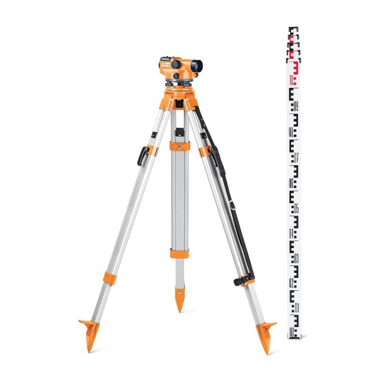
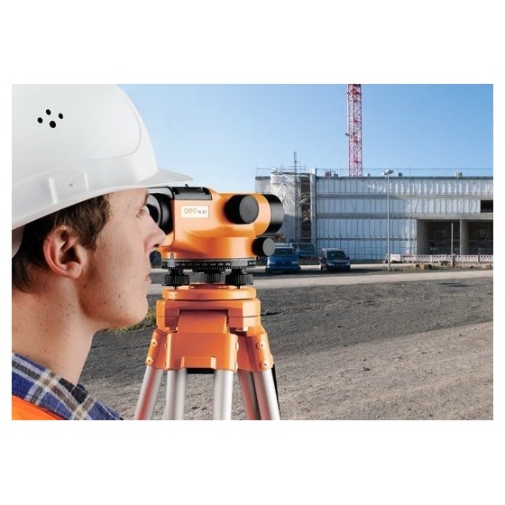
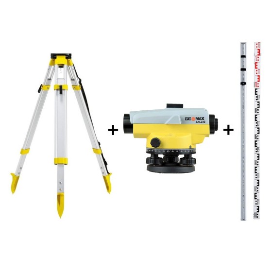
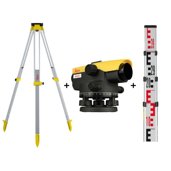
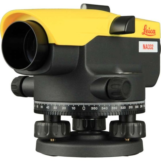
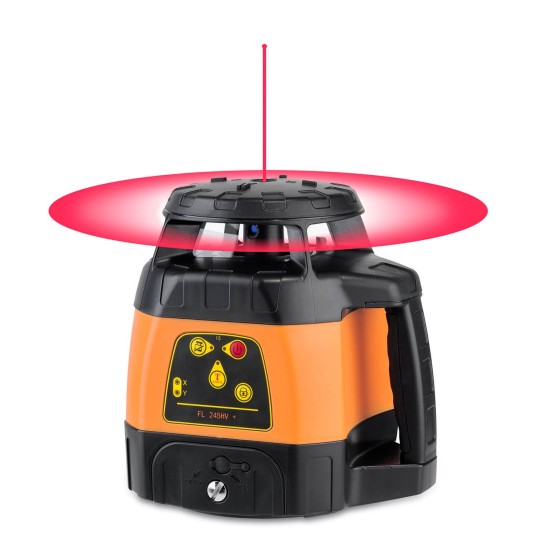
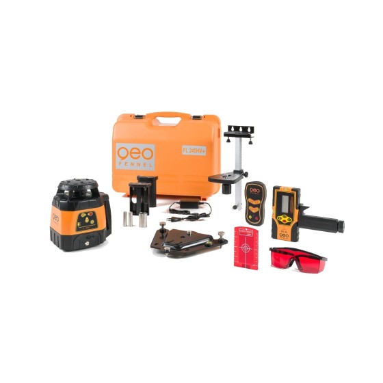
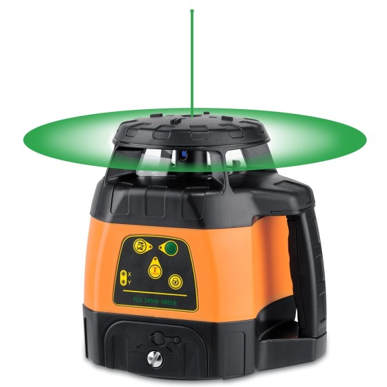
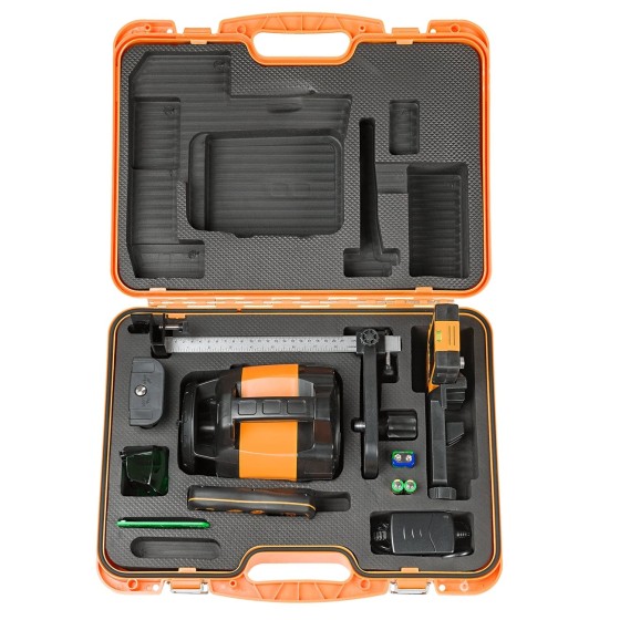
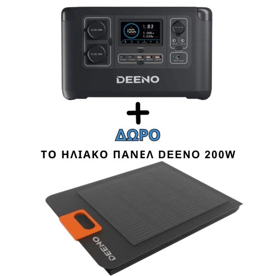
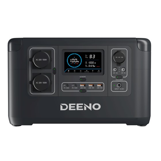
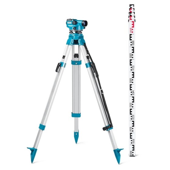
Geo-Fennel Auto Level ELN 24-SET (400 gon)
Raise the bar.
Levelling set with aluminium tripod and levelling staff – easy to use, reliable and robust.
Filter By
Brand
Brand
Price
Price
Use
Use
Horizontal circle
Horizontal circle
Accuracy at 1 km double leveling
Scope Magnification
Scope Magnification
Laser Beam
Laser Beam
Tilt Sensor
Tilt Sensor
Channels
Channels
UHF Radio modem
UHF Radio modem
Screen
Screen
Photo Resolution
Photo Resolution
Receiver for use with
Maximum Depth
Maximum Depth
Level Type
Level Type
Automatic Level Set
Automatic Level Set
Tether Length
Tether Length
IMU
IMU
Slope Setting
Slope Setting
Type
Type
Working Range with Receiver Ø
Horizontal Levelling
Vertical Levelling
Vertical Levelling
Features
Features
Raise the bar.
Levelling set with aluminium tripod and levelling staff – easy to use, reliable and robust.
Innovation: AUTO-DIST function measures the distance between laser plane ("0" level of receiver) and floor, wall, object automatically
Automatic Level suitable for all construction sites
GeoMax ZAL232 Automatic Level Package with Tripod & Levelling Staff.
Includes:
Leica NA324 Bundle Package. Includes GST103 aluminum tripod and CLR102 telescopic stage of 5 meter . The ideal package for high precision Surveying work. With the quality and guarantee of Leica Geosystems.
Leica NA332 Bundle Package. Includes GST103 aluminum tripod and CLR102 telescopic stage of 5 meter. The ideal package for high precision Surveying work. With the quality and guarantee of Leica Geosystems.
MicroSurvey CAD is a calculation-focused CAD platform for land surveyors and engineering professionals, designed to maximize efficiency and value by supporting many workflows and data formats in a single program.
A professional multipurpose laser for indoor and outdoor applications
A professional multipurpose laser for indoor applications
Deeno X1500 is a portable high-storage power station specially developed for indoor emergency backup. With a powerful 1036Wh capacity, 3000W peak power, and 1500W high power, the power station can simultaneously power 12 devices and is widely compatible with diverse appliances.
This model adds GPS position to the usage data recorded. Bluetooth connectivity allows seamless transfer of usage data to the C.A.T Manager Online cloud based system for near real-time monitoring of operators’ performance.
Flexible|Stable|Endless exploration
CHASING M2 S is an industrial-grade revolutionary underwater robot, which adopts an open-body design, intelligent flight control system and image algorithm, bringing unprecedented underwater perception and freedom of movement. 8 vectored-thrusters are symmetric and anti-stuck C-Motor 3.0 provide stable power, while the flagship sealed structure guarantees underwater operation performance. The ROV is compact and lightweight, easy to operate, and efficiently completes inspection tasks in various underwater operating scenarios in different industries.
iRTK5 is the new high quality GNSS receiver of Hi-Target, benefiting from the next-generation GNSS engine. It has full band support for cellular mobile networks (LTE, WCDMA, EDGE,GPRS,GSM), and supports most of the radio protocols on an internal UHF transceiver radio.