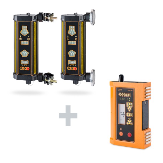
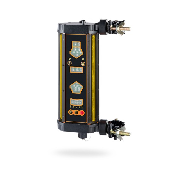
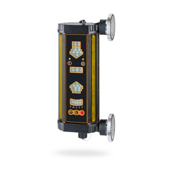
Geo-Fennel FMR 800-M/C Machine Control...
Machine control receiver used with construction machinery to increase accuracy and boost productivity. For continuous tilt and height control.
Filter By
Brand
Brand
Price
Price
Use
Use
Horizontal circle
Horizontal circle
Magnification
Magnification
Single Prism Range
Single Prism Range
Reflectorless Range
Reflectorless Range
Accuracy at 1 km double leveling
Scope Magnification
Scope Magnification
Tripod Material
Tripod Material
Detectes
Detectes
Laser Beam
Laser Beam
Tilt Sensor
Tilt Sensor
Channels
Channels
UHF Radio modem
UHF Radio modem
Screen
Screen
Photo Resolution
Photo Resolution
Receiver for use with
Pole for use with
Pole for use with
Level Type
Level Type
Range
Range
Accuracy (mm to 10 meters)
Digital Pointfinder
Digital Pointfinder
Tripod Type
Tripod Type
Automatic Level Set
Automatic Level Set
Laser Type
Laser Type
Touchscreen
Touchscreen
Tripod connection 1/4"
IMU
IMU
Slope Setting
Slope Setting
Type
Type
Lock System
Lock System
Total Station Type
Total Station Type
Angle measurement accuracy
Meter
Meter
Working Range with Receiver Ø
Automatic End-Piece
Automatic End-Piece
Duty Type
Duty Type
Measurement Type
Measurement Type
Incorporated Laser Beam
Staff for use with
Staff for use with
Horizontal Levelling
Vertical Levelling
Vertical Levelling
Tripod Thread
Tripod Thread
Optical Plummet
Optical Plummet
Machine control receiver used with construction machinery to increase accuracy and boost productivity. For continuous tilt and height control.
The versatile dual grade laser
Improved performance utilising PowerSwitch-Technology: The power of a class 3R in a class 2 laser.
4 mm laser beam diameter for optimised compatibility with our FMR 700/800 over long distances
Overview:
HTS-521L10 adopts a high-definition color screen to provide better human-computer interaction. The new optical design and absolute coding technology improve the measurement performance. High-precision compact bead shafting and sealed encoder disk enhance accuracy and stability. Built-in abundant measurement programs and comprehensive maintenance procedures will provide a new measurement experience.
Qmini A10 GIS Handheld provides a combination of Beidou high-precision positioning, dual-mode intercom, 4G smartphone, with background multi-network interconnection and other functions. It is small with complete functions and a high level of protection. Besides, it is a new type of rugged centimeter-level precision intelligent terminal product.
iRTK5 is the new high quality GNSS receiver of Hi-Target, benefiting from the next-generation GNSS engine. It has full band support for cellular mobile networks (LTE, WCDMA, EDGE,GPRS,GSM), and supports most of the radio protocols on an internal UHF transceiver radio.
The Qpad X8 Rugged Tablet integrates the high-precision GNSS algorithm to provide users with a consumer-grade smart tablet experience for GIS data collection in various industries.
HTS-720 features a 5.5-inch touch high-definition large screen, powered by the Android operating system and our brand-new Android measurement software. With the addition of a built-in camera, measuring and stakeout tasks have never been easier. Plus, the HTS-720 boasts a high-performance processor, enabling users to select stakeout points and lines with just one click in CAD stakeout interface, making the entire stakeout process more intuitive and efficient.
HD-Lite echo sounder is a rugged and compact PC built-in professional portable echo sounder. Boosted by an upgraded sounder platform and enhanced hardware, HD-Lite provides users with a portable solution with accuracy and credibility.
Hi-Target HD-MAX dual-frequency echo sounder is universal in sediment measurement for dredging and other water depth measurement projects in shallow water, deep water and sandy water. The full-featured Hi-MAX Sounder hydrographic software integrates bathymetry, navigation, and post-processing. Equipped with the 17’’ large screen and industrial computer platform, HD-MAX offers a set of reliable solution for hydrographic offices around the world along with a robust dual-frequency transducer and a user-friendly survey pole.