lcp

Filter By

Brand

Brand

Price

Price

  • €0.00 - €24,800.00

Horizontal circle

Horizontal circle

Magnification

Magnification

Single Prism Range

Single Prism Range

Reflectorless Range

Reflectorless Range

Accuracy at 1 km double leveling

Accuracy at 1 km double leveling

Scope Magnification

Scope Magnification

Tripod Material

Tripod Material

Detectes

Detectes

Laser Beam

Laser Beam

Tilt Sensor

Tilt Sensor

Compatible with

Compatible with

Model

Model

Included Sensor

Included Sensor

Channels

Channels

UHF Radio modem

UHF Radio modem

Screen

Screen

Photo Resolution

Photo Resolution

Receiver for use with

Receiver for use with

Maximum Depth

Maximum Depth

Pole for use with

Pole for use with

Level Type

Level Type

Range

Range

Accuracy (mm to 10 meters)

Accuracy (mm to 10 meters)

Digital Pointfinder

Digital Pointfinder

Tripod Type

Tripod Type

Automatic Level Set

Automatic Level Set

Laser Type

Laser Type

P2P Package

P2P Package

Touchscreen

Touchscreen

Tripod connection 1/4"

Tripod connection 1/4"

Tether Length

Tether Length

IMU

IMU

Slope Setting

Slope Setting

Type

Type

Lock System

Lock System

Total Station Type

Total Station Type

Angle measurement accuracy

Angle measurement accuracy

Meter

Meter

Working Range with Receiver Ø

Working Range with Receiver Ø

Automatic End-Piece

Automatic End-Piece

Duty Type

Duty Type

Measurement Type

Measurement Type

Incorporated Laser Beam

Incorporated Laser Beam

Staff for use with

Staff for use with

Horizontal Levelling

Horizontal Levelling

Vertical Levelling

Vertical Levelling

Tripod Thread

Tripod Thread

Optical Plummet

Optical Plummet

Features

Features

GeoMax Zenith06 Pro GNSS... GeoMax Zenith06 Pro GNSS...
  • New
Quick View
WishList
Compare
Add To Cart

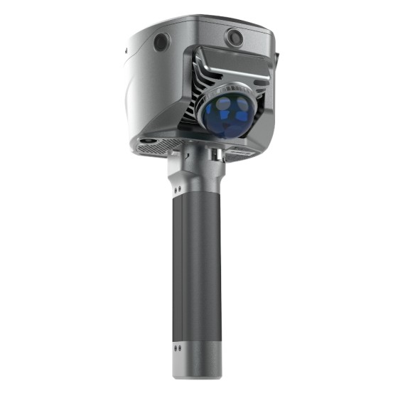
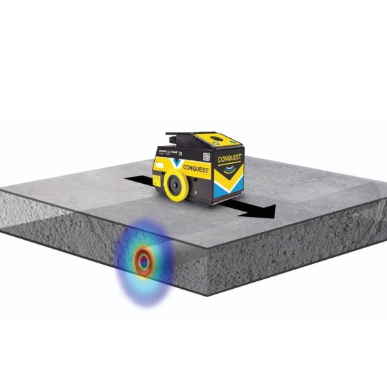
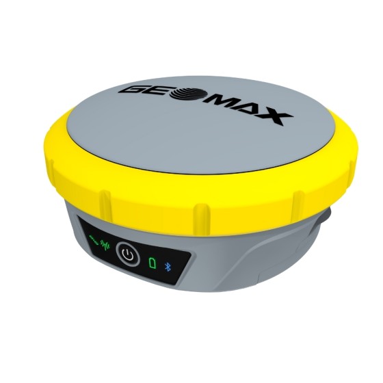
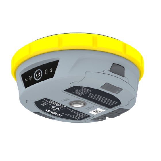
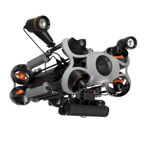
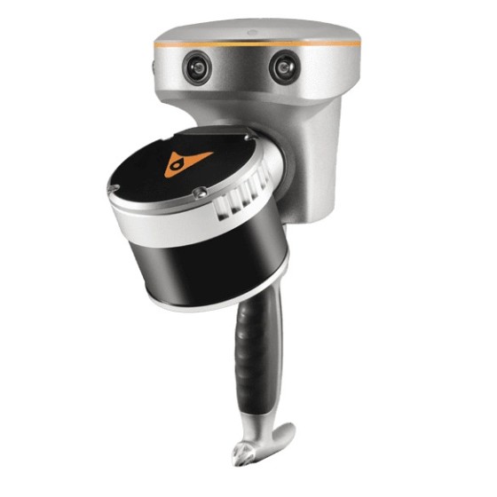
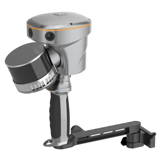
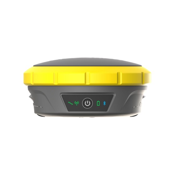
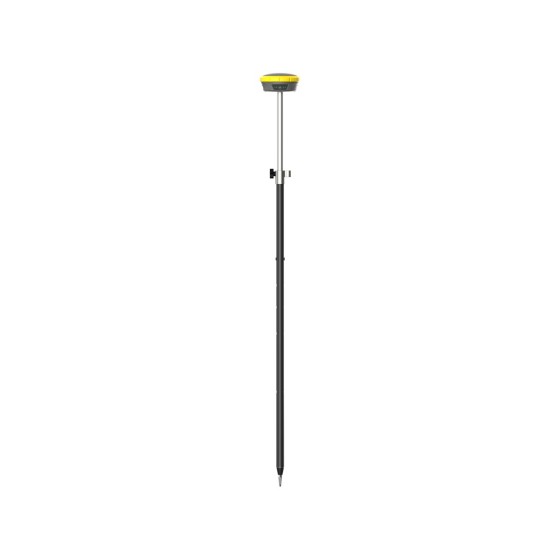
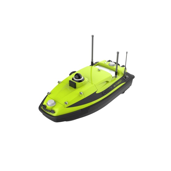
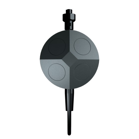
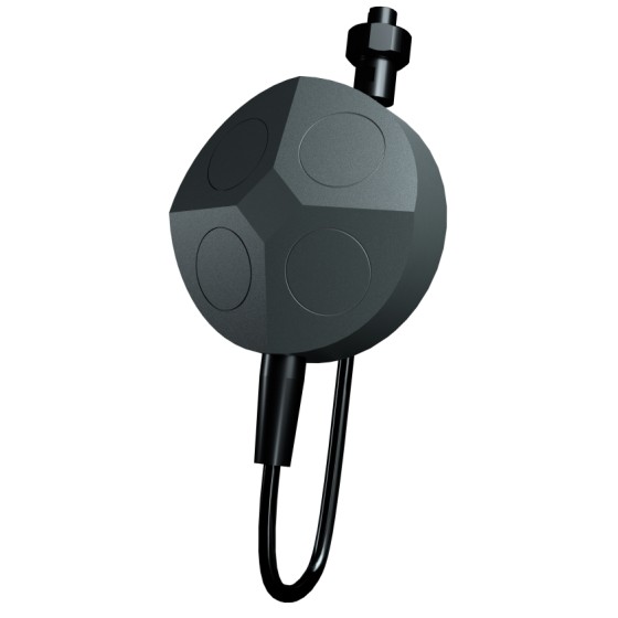
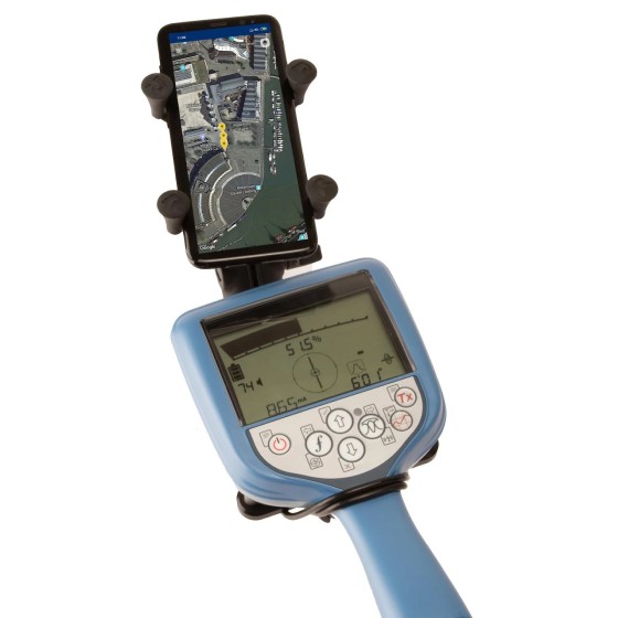
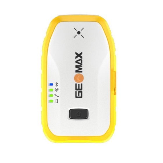
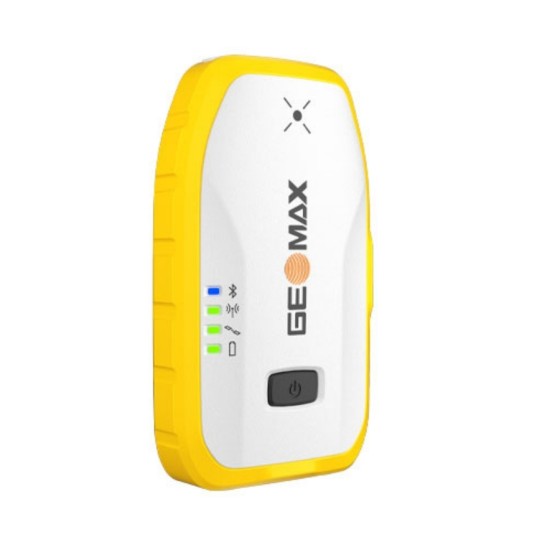
GeoMax Zenith06 Pro GNSS Smart Antenna

Tilt easy, measure fast

The Zenith06 Pro brings tilt compensation to our lightest and easiest to use smart antenna for accurate and flexible GPS site work. Connected to X-PAD software, the Zenith06 Pro means faster work and higher productivity in a streamlined digital workflow that takes you from site to office and the cloud.

CHASING HANJIE C750D... CHASING HANJIE C750D...
Quick View
WishList
Compare
Add To Cart

CHASING HANJIE C750D Multi-Beam Imaging...

HANJIE C750D multibeam imaging sonar can penetrate turbid waters and provide real-time imaging. It is capable of surveying large underwater areas while also enabling detailed close-range observation.

RadioDetection CONQUEST 100... RadioDetection CONQUEST 100...
Quick View
WishList
Compare
Add To Cart

RadioDetection CONQUEST 100 Ground...

Concrete scanning with GPR made simple

CONQUEST 100 GPR  is a light, portable device that provides a fast, non-invasive method to image objects in concrete prior to cutting and coring. Using CONQUEST 100 will reduce risk by ensuring you do not damage critical infrastructure and provides a non-destructive method to inspect concrete structures. 

GeoMax Zenith55 GNSS Smart... GeoMax Zenith55 GNSS Smart...
Quick View
WishList
Compare
Add To Cart

GeoMax Zenith55 GNSS Smart Antenna

The Zenith55 is a professional-grade GNSS smart antenna that combines advanced features with practical value, all backed by exemplary GeoMax support. It offers efficient workflows that generate a strong return on investment for construction and surveying professionals.

GeoMax Zoom45 Android... GeoMax Zoom45 Android...
Quick View
WishList
Compare
Add To Cart

GeoMax Zoom45 Android Manual Total Station

The Zoom45 is the go-to manual total station for construction surveyors and operator crews thanks to its fast point measurements, durability, and simple operation. Perfect for job sites, the robust Zoom45 runs X-PAD Ultimate field software on a large display, great for working with graphical tools to quickly complete layout tasks. Additionally, easily exchange data with the office via X-PAD 365 and continue working in the same software ecosystem, bringing an efficient digital dataflow to your work with manual total stations.

Angle measurement accuracy
2"
5"
GeoMax Zeta125 Pipe Laser GeoMax Zeta125 Pipe Laser
Quick View
WishList
Compare
Add To Cart

GeoMax Zeta125 Pipe Laser

With functional and versatile configuration, a full range of features and a tough design, the Zeta series fit all your needs, getting an error-free job done – no matter what the situation or the environmental conditions might be.

Highlights:

  • Range up to 900 feet
  • Accuracy ±10 arc second 
  • Self-leveling range -15% to +45%
  • Grade range -10% to +40%
  • Includes long-range IR remote control
  • Fits in 5-inch diameter pipes
  • Large LCD display with backlight
SatLab HydroBoat 1500 USV SatLab HydroBoat 1500 USV
Quick View
WishList
Compare
Add To Cart

SatLab HydroBoat 1500 USV

The HydroBoat 1500 is a versatile, intelligent USV designed for underwater topographic surveys of lakes, rivers, and reservoirs by carrying the HydroBeam M4 Portable Multibeam Echo Sounder system. Equipped with a high-precision GNSS receiver and IMU for position and orientation, the HydroBoat 1500 ensures sub-meter accuracy even when satellite signals are blocked. t features a lightweight and robust hull with IP67-waterproof, as well as four powerful thrusters on the sides that enhance mobility and flexibility, allowing it to easily adapt to diverse aquatic environments and efficiently complete underwater terrain surveys.

SatLab HydroBoat 1200 USV SatLab HydroBoat 1200 USV
Quick View
WishList
Compare
Add To Cart

SatLab HydroBoat 1200 USV

HydroBoat 1200—an embodiment of compactness and ease, tailored for seamless operation across a spectrum of equipment.

Enhanced by professional CFD technology, its stability finds new heights. Melded with high-precision single-beam echo sounder, GNSS directional positioning receiver, and an advanced intelligent boat-control system, it deftly serves varied water operational demands.

QYSEA E-MASTER Υποβρύχιο Drone QYSEA E-MASTER Υποβρύχιο Drone
Quick View
WishList
Compare
Add To Cart

QYSEA E-MASTER Υποβρύχιο Drone

The FIFISH E-MASTER is a revolutionary industrial AI underwater robot, engineered for high-precision measurements, inspections, and surveys in complex marine environments. With advanced sensors and sonars, it ensures unmatched accuracy and reliability. Its modular design allows for quick and efficient component changes, including accessory swaps and power replacements.

CHASING X Underwater ROV CHASING X Underwater ROV
Quick View
WishList
Compare
Add To Cart

CHASING X Underwater ROV

The new Chasing X is an industrial-grade underwater robot designed for ultimate flexibility and performance. It features a smart omnidirectional anti-current system, providing precise control even in turbulent waters. With stable handling and the ability to manage heavy loads, the Chasing X is the ideal partner for demanding underwater missions

  • Speed: 2.3 m/s
  • Smart omnidirectional anti-current system
  • 180° hemispherical view with e-PTZ
  • SDK open platform
CHASING Cerulean Omniscan... CHASING Cerulean Omniscan...
Quick View
WishList
Compare
Add To Cart

CHASING Cerulean Omniscan 450 FS Sonar

The Omniscan 450 FS sonar is a professional-grade underwater scanning system that uses high-definition technology to penetrate murky waters, generating real-time seabed maps at depths of up to 300 meters. With the intelligent SonarView software, it offers multiple display options for intuitive and efficient results, while supporting data replay and export for simplified analysis. Its easy installation and dual-sonar coordination enhance underwater operational efficiency, making it an ideal tool for locating and searching in murky waters.

Edition
100m
300m
CHCNAV RS10 Handheld SLAM... CHCNAV RS10 Handheld SLAM...
Quick View
WishList
Compare
Add To Cart

CHCNAV RS10 Handheld SLAM 3D Scanner &...

The RS10 combines GNSS RTK, laser scanning, and visual SLAM technologies for precise 3D scanning and surveying in diverse environments, offering versatility and accuracy for professionals in surveying, civil engineering, construction, mining and other industries. 

GeoMax Zenith60 Pro GNSS... GeoMax Zenith60 Pro GNSS...
Quick View
WishList
Compare
Add To Cart

GeoMax Zenith60 Pro GNSS Smart Antenna

Redefining Accuracy and Reliability

The GeoMax Zenith60 Pro is the tool of choice for construction and surveying professionals who want their job done accurately and on time. It is a robust, durable and highly reliable GNSS smart antenna designed for high performance even in challenging conditions. Fully integrated with the GeoMax ecosystem – TPS and X-PAD Suite - it offers a comprehensive solution, resulting in unmatched precision and efficiency.

SatLab HydroBoat 990 USV SatLab HydroBoat 990 USV
Quick View
WishList
Compare
Add To Cart

SatLab HydroBoat 990 USV

Truly convenient, truly powerful, and truly reliable HydroBoat 990 is an Android-powered USV system for bathymetric surveys. With only one man, one boat, and one controller to get the bathymetric surveys done. With easy-to-use Android software and an integrated and practical boat structure, the HydroBoat 990 sails fast and measures accurately with excellent technical performance.

GeoMax X-PAD Office Fusion
Quick View
WishList
Compare
Add To Cart

GeoMax X-PAD Office Fusion

The Geospatial Data Office Software

X-PAD Office Fusion is a desktop software integrating geospatial data from TPS, GNSS, scanners and other sensors in a single environment.

Hi-Target iBoat BS12 USV... Hi-Target iBoat BS12 USV...
Quick View
WishList
Compare
Add To Cart

Hi-Target iBoat BS12 USV Android-powered...

The iBoat BS12 emerges as the embodiment of sophistication and simplicity, expertly designed for effortless operation across a multitude of applications.

Engineered with the latest CFD technology and boasting a sleek carbon fiber and Kevlar hull, the iBoat BS12 is as tough as it is elegant. Its corrosion-resistant construction ensures durability in even the harshest conditions.

Matched with the newly developed boat control system and a robust 40km range battery, it achieves a remarkable top speed of 6 m/s, all while maintaining stability in tumultuous waters. For precise navigational accuracy, the integrated IMU offers sub-meter positioning capabilities.

CHASING Waterlinked DVL A50... CHASING Waterlinked DVL A50...
Quick View
WishList
Compare
Add To Cart

CHASING Waterlinked DVL A50 Kit

Compatible with M2 PRO, M2 PRO MAX

CHASING Waterlinked DVL Kit is a doppler velocity log accessory suite developed for CHASING M2, M2 PRO and M2 PRO MAX. Waterlinked DVL is the world's smallest DVL by far. It has attributes of high-performance, ultra-small 4 beam setup, Integrated AHRS /IMU, open interface protocol and low cost. With the assistance of a DVL, ROVs can perform hovering, fixed-point location, and position correction, ensuring the ROV navigates accurately.

RD Map™ Android App RD Map™ Android App
Quick View
WishList
Compare
Add To Cart

RD Map™ Android App

RD Map™ is the free Map&Share™ Android app which supports Radiodetection’s Bluetooth Precision locators and allows locator technicians to create detailed maps of buried utilities and share them directly from the field.

Boxed:

Sticky Add To Cart

Font: