Full-Constellation Tracking: Strong Signal & High-Quality Data
- Channels: 1408
- GNSS Chip: New SoC chip, low power consumption, extended battery life
- Technology: Multi-frequency anti-interference and adaptive filtering for strong signal, high-quality data, and excellent accuracy
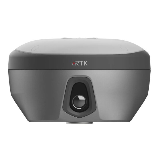
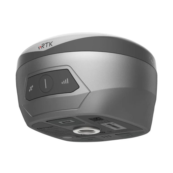
Innovative Industrial Design
- Design: Compact & lightweight for easy handling
- Lock Mechanism: Metal lock securely connects device and battery handle for stable operation
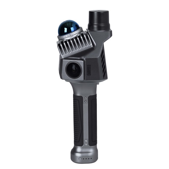
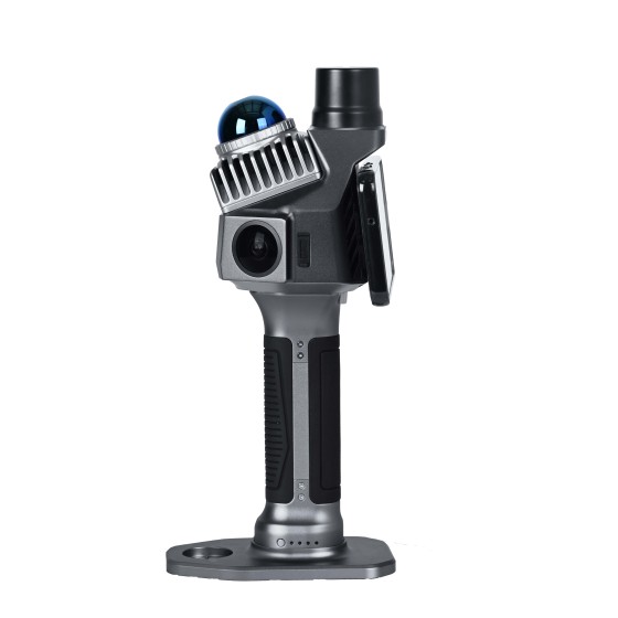
Contactless Measurement
- Geospatial Data Collection: Utilizes laser point cloud and image data for real-time, efficient, and convenient acquisition of rich geospatial information
- GNSS Expansion: Enables measurements in areas like under bridges, culverts, and enclosed spaces, ensuring safe and efficient operations
- Smart Imaging: Android-powered laser point cloud and image processing; capture a photo to obtain multiple point coordinates with <5cm accuracy within 15m, doubling work efficiency
Unified Coordinate Framework
- Positioning Integration: Indoor & outdoor positioning integration with unified coordinate system; outputs point cloud in BLH or NEZ format
- Workflow Solution: End-to-end solution from field data acquisition to final results
Laser Reverse Positioning Technology: Precision Measurement without Signal
- Laser Reverse Positioning: Maintains 5 cm accuracy for up to 10 minutes or within a 100 m radius without satellite signal
- RTK Enhancement: Solves the "last 100 meters" problem in traditional RTK measurement tasks
Volume Calculation
- Laser Point Cloud Data: Real-time 3D data capture of ground objects
- Efficient Processing: Fast and convenient analysis using high-performance Android-based technology
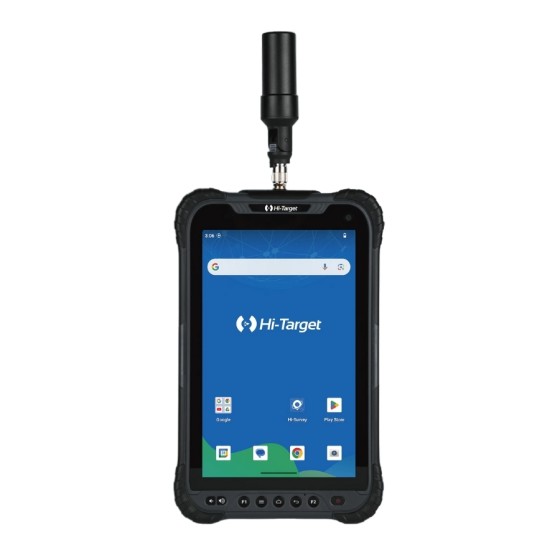
8-INCH ROBUST TABLET
- Processor: 2.0GHz, 8-core high-speed processor
- Memory: 6+128GB large memory
- Battery: 8200 mAh high-capacity battery
- Operating System: Android 10 for smoother performance
APPLICATIONS
- Urban Renewal
- Volume Measurement
- Tunnel Surveying
- Forestry Survey
- Underground Pipelines
- Architectural Survey
SOFTWARE
Hi-Survey Field Software
- High-performance laser point cloud & image processing engine for real-time solutions and visualization.
- Precision heat map display allows users to monitor accuracy in real time.
- Integrates industry-leading CAD & real-scene engines for an intuitive, visual measurement and layout experience.
Office Software for Post-processing
- Hi-LiDAR software refines real-time data, delivering point clouds with sub-2 cm thickness and <1 cm relative measurement precision.
- Automated excavation analysis: Calculates over/under-excavation for tunnel sections, enabling construction progress tracking and validation.
- Advanced section visualization & drafting: Supports horizontal/vertical section views, aiding in renovation planning for older buildings with precise architectural measurements.
TECHNICAL SPECIFICATIONS
GNSS Configuration
-
Channel: 1408
-
GNSS Signals:
• GPS: L1C/A, L1C, L2P(Y), L2C, L5
• BDS: B11, B2, B31, B1C, B2a, B2b
• GLONASS: L1, L2, L3
• GALILEO: E1, E5a, E5b, E6
• QZSS: L1, L2, L5, L6
• NavIC: L5
• SBAS: L1, L2, L5
• PPP: B2b-PPP, E6-HAS
Output Format & Rate
-
ASCII: NMEA-0183, Binary
-
Output rate: 1Hz - 20Hz
-
Static data format: GNS, Rinex
-
Real Time Kinematic: RTCM2.X, RTCM3.X
-
Network Mode: VRS, FKP, MAC, supports NTRIP protocol
System Configuration
Accuracy and Reliability
-
Horizontal (H) Accuracy:
• High-Precision Static: 2.5 mm + 0.1 ppm RMS
• Static and Fast Static: 2.5 mm + 0.5 ppm RMS
• PPK: 8 mm + 1 ppm RMS
• PPP: 10 cm
• Code Differential: ±0.25 m + 1 ppm RMS
• SBAS: 0.5 m (H), 0.85 m (V)
-
Vertical (V) Accuracy:
• High-Precision Static: 3.5 mm + 0.4 ppm RMS
• Static and Fast Static: 5 mm + 0.5 ppm RMS
• PPK: 15 mm + 1 ppm RMS
• PPP: 20 cm
• Code Differential: ±0.5 m + 1 ppm RMS
-
Initialization time: Typically <10s
-
Initialization reliability: Typically >99.9%
-
Tilt survey accuracy: 8 mm + 0.3 mm/° tilt
Image Measurement & AR Stakeout
-
Single photo can acquire multiple point coordinates with accuracy better than 5 cm within 15 meters
-
After satellite signal loss, accuracy of 5 cm guaranteed for 10 minutes or within 100 m activity radius
-
Supports AR stakeout, image measurement, working distance 2-15 m
-
3 professional dual HD cameras
-
Pixel range: 0.1 - 40 m @10%, 0.1 - 70 m @80%
-
Laser scanner: Class 1 Eye Safe
-
Field of View (FOV): Horizontal 160°, Vertical 59°
-
Update rate: 200 Hz
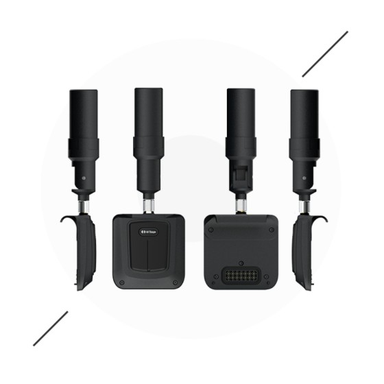
Communication & Interfaces
-
USB Type C port, SMA antenna port, Nano SIM card slot
-
Network: TDD-LTE, FDD-LTE, GSM
-
WiFi: IEEE 802.11a/b/g/n/ac/ax, 2.4 GHz / 5 GHz, WiFi hotspot
-
Bluetooth 5.2
-
Internal UHF Radio: Power 0.5W/1W adjustable, Frequency 410 MHz - 470 MHz
-
Protocols supported: HI-TARGET, TRIMTALK450S, TRIMMARK III, SATEL-3AS, TRANSEOT, etc.
-
Channels: 116 (16 scalable)
Additional Features
-
Built-in high-precision IMU module
-
Electronic bubble sensor
-
Tilt survey
-
Single physical button
-
2.8-inch touch screen (480 x 640 pixels)
-
NFC, Web UI, Firmware upgrade via U-disk
-
Intelligent voice prompts, self-check, message push, online upgrade, remote control
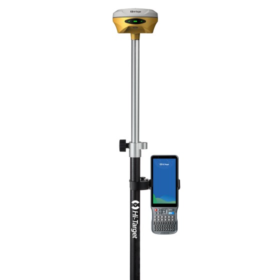
Power & Battery
-
Lithium battery with portable charger
-
RTK rover (UHF/Cellular): up to 10 hours operation
-
USB 45W fast charging, fully charged in 2 hours
-
SLAM mode battery life: up to 5 hours
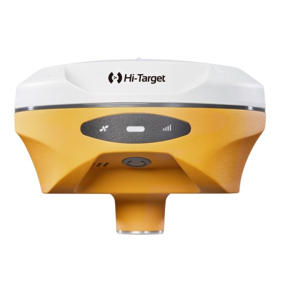
Physical & Environmental Specifications
-
Dimensions: 134.4 mm x 109.9 mm
-
Weight: 1.68 kg
-
Water/dust proof rating: IP64
-
Humidity: 100% non-condensing
-
Operating temperature: -20 °C to +55 °C
-
Storage temperature: -40 °C to +70 °C