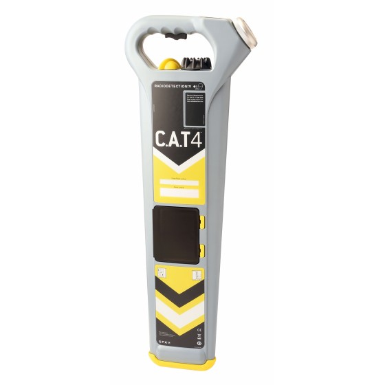
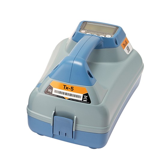
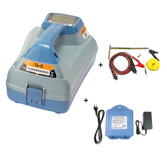
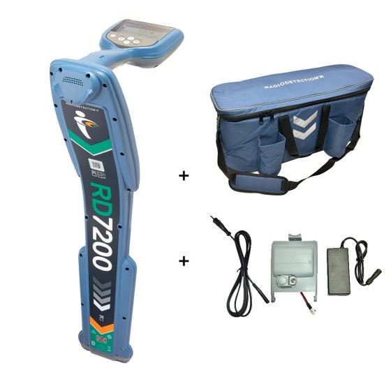
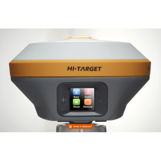
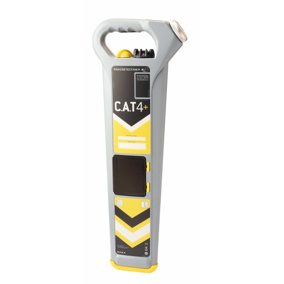
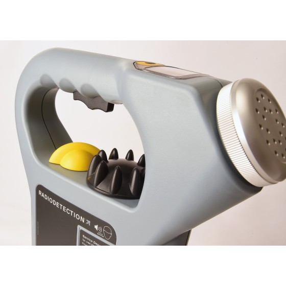
RadioDetection C.A.T4+, Metric, Depth
The C.A.T4+ offers the same locating performance as the C.A.T4 but with addition of Depth measurement, allowing better identification of the route of buried utilities.
Filter By
Brand
Brand
Price
Price
Magnification
Magnification
Single Prism Range
Single Prism Range
Reflectorless Range
Reflectorless Range
Tilt Sensor
Tilt Sensor
Channels
Channels
UHF Radio modem
UHF Radio modem
Screen
Screen
Photo Resolution
Photo Resolution
IMU
IMU
Type
Type
Total Station Type
Total Station Type
Angle measurement accuracy
Features
Features
The C.A.T4+ offers the same locating performance as the C.A.T4 but with addition of Depth measurement, allowing better identification of the route of buried utilities.
The C.A.T4 is the standard model of the range. Using it with the Genny4 transmitter, operators will be able to find more buried utilities, faster to drive best locating practice, reduce the number of cable strikes, and dig more safely.
GA-52Cx is the most popular model in the Schonstedt range, having been sold for over 20 years. It is robust and reliable: designed for locating and tracing down to 5.5m.
Features:
Our popular GA-92XTd magnetic locator was introduced in 2002 and quickly became known as perhaps the most portable and easy-to-use magnetic metal locator on the market. With one hand, you can detect the magnetic fields of all ferromagnetic objects property markers, manholes, septic tanks, well casings, valve boxes, cast iron pipes, steel drums, unexploded ordnance up to sixteen feet below the surface.
Features:
The GA-72Cd Locator detects the magnetic field of iron and steel objects. It provides audio detection signals that peak in frequency when the locator’s tip is held directly over the target. The GA-72Cd has the option of nulling or peaking.
Features:
The C.A.T4+ offers the same locating performance as the C.A.T4 but with addition of Depth measurement, allowing better identification of the route of buried utilities.
This model adds GPS position to the usage data recorded. Bluetooth connectivity allows seamless transfer of usage data to the C.A.T Manager Online cloud based system for near real-time monitoring of operators’ performance.
RadioDetection FlexiTrace (Genny/Tx Powered Pushrod Transmitter). The Flexitrace is an easy to use cost effective method of tracing the route of non metallic small diameter pipes. Available in 2 versions: 50 & 80 meters.
Based on a fully digital platform, the Tx family of signal transmitters has been designed to complement Radiodetection’s advanced high-precision cable and pipe locators including the RD8200 and Marker Locator ranges.
The Tx range is designed to meet the demands of tracing utilities through today’s complex underground infrastructure. The Tx-5 has a medium power and induction capability as well as Fault-Find. The Tx-10 has the highest power capability with both Fault-Find and CD modes as standard.
HTS-521L10 adopts a high-definition color screen to provide better human-computer interaction. The new optical design and absolute coding technology improve the measurement performance. High-precision compact bead shafting and sealed encoder disk enhance accuracy and stability. Built-in abundant measurement programs and comprehensive maintenance procedures will provide a new measurement experience.
Qmini A10 GIS Handheld provides a combination of Beidou high-precision positioning, dual-mode intercom, 4G smartphone, with background multi-network interconnection and other functions. It is small with complete functions and a high level of protection. Besides, it is a new type of rugged centimeter-level precision intelligent terminal product.
-Locating and marking buried utilities quickly, accurately and safely-
The new RD7200 is a no compromise all-industry locator, designed for accurate and effective every day use.
Intended Use:
iRTK5 is the new high quality GNSS receiver of Hi-Target, benefiting from the next-generation GNSS engine. It has full band support for cellular mobile networks (LTE, WCDMA, EDGE,GPRS,GSM), and supports most of the radio protocols on an internal UHF transceiver radio.
The Qpad X8 Rugged Tablet integrates the high-precision GNSS algorithm to provide users with a consumer-grade smart tablet experience for GIS data collection in various industries.
HTS-720 features a 5.5-inch touch high-definition large screen, powered by the Android operating system and our brand-new Android measurement software. With the addition of a built-in camera, measuring and stakeout tasks have never been easier. Plus, the HTS-720 boasts a high-performance processor, enabling users to select stakeout points and lines with just one click in CAD stakeout interface, making the entire stakeout process more intuitive and efficient.
Damage prevention and operational efficiency are the biggest challenges facing our customers
Solve these problems with the new RD8200®. Designed with the operator in mind, it is our most advanced and capable range of precision locators.
Intended Use:
HD-Lite echo sounder is a rugged and compact PC built-in professional portable echo sounder. Boosted by an upgraded sounder platform and enhanced hardware, HD-Lite provides users with a portable solution with accuracy and credibility.
Mapping and Digital Solutions Precision Locator Range
Locate and map buried utilities in a single operation with the RD8200SG - Survey Grade. The RD8200SG is our most advanced, combined mapping and utility locating solution that enables users to map buried utilities with survey grade accuracy.
Hi-Target HD-MAX dual-frequency echo sounder is universal in sediment measurement for dredging and other water depth measurement projects in shallow water, deep water and sandy water. The full-featured Hi-MAX Sounder hydrographic software integrates bathymetry, navigation, and post-processing. Equipped with the 17’’ large screen and industrial computer platform, HD-MAX offers a set of reliable solution for hydrographic offices around the world along with a robust dual-frequency transducer and a user-friendly survey pole.