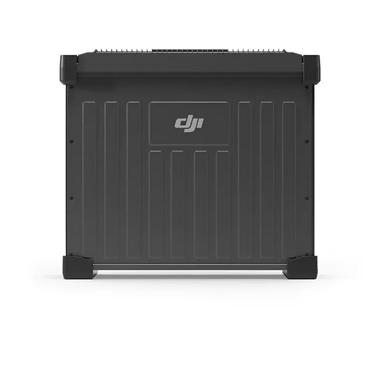
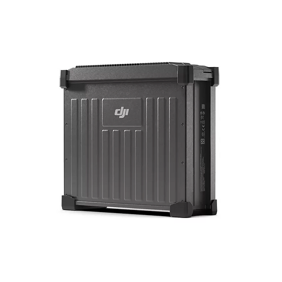
DJI Agras T50 DB1560 Intelligent Flight...
DJI Agras T50 DB1560 Intelligent Flight Battery
Filter By
Brand
Brand
Price
Price
Use
Use
Horizontal circle
Horizontal circle
Magnification
Magnification
Single Prism Range
Single Prism Range
Reflectorless Range
Reflectorless Range
Accuracy at 1 km double leveling
Scope Magnification
Scope Magnification
Laser Beam
Laser Beam
Tilt Sensor
Tilt Sensor
Compatible with
Compatible with
Model
Model
Included Sensor
Included Sensor
Channels
Channels
UHF Radio modem
UHF Radio modem
Screen
Screen
Photo Resolution
Photo Resolution
Receiver for use with
Maximum Depth
Maximum Depth
Pole for use with
Pole for use with
Level Type
Level Type
Range
Range
Accuracy (mm to 10 meters)
Digital Pointfinder
Digital Pointfinder
Automatic Level Set
Automatic Level Set
Laser Type
Laser Type
P2P Package
P2P Package
Touchscreen
Touchscreen
Tripod connection 1/4"
Tether Length
Tether Length
IMU
IMU
Slope Setting
Slope Setting
Type
Type
Total Station Type
Total Station Type
Angle measurement accuracy
Meter
Meter
Working Range with Receiver Ø
Automatic End-Piece
Automatic End-Piece
Incorporated Laser Beam
Staff for use with
Staff for use with
Horizontal Levelling
Vertical Levelling
Vertical Levelling
Tripod Thread
Tripod Thread
Optical Plummet
Optical Plummet
Features
Features
DJI Agras T50 DB1560 Intelligent Flight Battery
The GeoMax Zone60 DG Fully-Automatic Dual Grade Laser is a fully-automatic device designed for construction workers who need the dependability of a professional grade laser on a daily basis. With a working range of up to 3,000 feet, the Zone60 DG also boasts an accuracy of ±1/16-inch at 100 feet. The Zone60 DG self-levels within ±5 degrees in both horizontal and vertical direction.
Highlights
Based on a fully digital platform, the Tx family of signal transmitters has been designed to complement Radiodetection’s advanced high-precision cable and pipe locators including the RD8200 and Marker Locator ranges.
The Tx range is designed to meet the demands of tracing utilities through today’s complex underground infrastructure. The Tx-5 has a medium power and induction capability as well as Fault-Find. The Tx-10 has the highest power capability with both Fault-Find and CD modes as standard.
HTS-521L10 adopts a high-definition color screen to provide better human-computer interaction. The new optical design and absolute coding technology improve the measurement performance. High-precision compact bead shafting and sealed encoder disk enhance accuracy and stability. Built-in abundant measurement programs and comprehensive maintenance procedures will provide a new measurement experience.
Flexible|Stable|Endless exploration
CHASING M2 S is an industrial-grade revolutionary underwater robot, which adopts an open-body design, intelligent flight control system and image algorithm, bringing unprecedented underwater perception and freedom of movement. 8 vectored-thrusters are symmetric and anti-stuck C-Motor 3.0 provide stable power, while the flagship sealed structure guarantees underwater operation performance. The ROV is compact and lightweight, easy to operate, and efficiently completes inspection tasks in various underwater operating scenarios in different industries.
-Locating and marking buried utilities quickly, accurately and safely-
The new RD7200 is a no compromise all-industry locator, designed for accurate and effective every day use.
Intended Use:
Easily perform leveling tasks over great distances with the Geomax Zone75 DG Fully-Automatic Dual Grade Laser. This rotary laser provides the same high-level performance as Zone80 (phased out in 2021) but with a reduced rotation speed of 900rpm, enabling it to produce a more stable beam at distances of up to 550 meters away from the laser. This makes it a great choice for land leveling and agriculture applications.
Highlights
Schneider Digital’s 3D PluraView is the enhanced successor of PLANAR’s discontinued Beamsplitter series, as well as the NVIDIA 3D Vision Pro. Innovative, reliable technology is the basis for precise, pixel-accurate, stereoscopic image evaluation in the highest quality, even in daylight. For this, 3D PluraView Beamsplitter technology delivers full monitor resolution up to 4K/UHD @ 10-bit in brilliant brightness thanks to one display per eye. This allows the user to work comfortably and without fatigue in all 3D stereo applications.
The GeoMax Zoom10 Manual Total Station is what you get when you put affordability and efficiency into one manual total station. It is a high-performing entry-level survey instrument available at an excellent price point.
Highlights
Note: X-PAD field software is sold separately.
Capture More, Worry Less
Special Promotion Price
Grab the V10i and get measuring. Integrating an OLED screen, IMU, and two cameras, the V10i gives us a next-level productivity boost. The AR Stakeout gives you real-time visual guidance on stakeouts. The Visual Measure achieves the measurement of hard-to-access locations. An OLED screen will bring a new interactive experience for Surveyors.
iRTK5 is the new high quality GNSS receiver of Hi-Target, benefiting from the next-generation GNSS engine. It has full band support for cellular mobile networks (LTE, WCDMA, EDGE,GPRS,GSM), and supports most of the radio protocols on an internal UHF transceiver radio.
HTS-720 features a 5.5-inch touch high-definition large screen, powered by the Android operating system and our brand-new Android measurement software. With the addition of a built-in camera, measuring and stakeout tasks have never been easier. Plus, the HTS-720 boasts a high-performance processor, enabling users to select stakeout points and lines with just one click in CAD stakeout interface, making the entire stakeout process more intuitive and efficient.
CHASING M2 Pro is a professional underwater ROV designed for professional users and industrial applications. M2 Pro has 8 Vectored Thrusters layout allows OMNI movement in all directions. Compared to the CHASING M2, the M2 Pro has been upgraded by 50%. The Maximum speed is 4 knots, depth is 150 meters and the maximum horizontal radius is 400 meters.
Damage prevention and operational efficiency are the biggest challenges facing our customers
Solve these problems with the new RD8200®. Designed with the operator in mind, it is our most advanced and capable range of precision locators.
Intended Use:
-Digital twin capture reimagined, re-engineered, and ready for anything-
Matterport’s newest 3D camera scans properties faster than earlier versions so you can accelerate project completion. Pro3 provides the highest accuracy scans of both indoor and outdoor spaces. Share models with your team online using a Matterport subscription to improve efficiency and collaboration.
CHASING M2 PRO MAX is an industrial-grade underwater remote operated vehicle (ROV) designed for government and enterprise users. It is equipped with eight vectored thrusters, allowing 360-degree omnidirectional movements. The ROV can navigate at a maximum speed of 3 knots, dive to 200 meters deepwater, and move around a maximum horizontal radius of 400 meters.
SLAM-empowered lightweight handheld laser scanner for easy reality capture. Scan environments as you walk and create 3D models, floor plans and BIM. With an internal grip battery, it allows for a more balanced weight distribution, which not only enhances the overall using experience but also conforms to ergonomic principles.
Air Surveyor 4 is a high quality, handmade drone designed and made in Greece, specialized for topographic applications. It provides a complete range of new and improved functions with emphasis on the final result, simplifying its use in the field (easier to use and safer).
HD-Lite echo sounder is a rugged and compact PC built-in professional portable echo sounder. Boosted by an upgraded sounder platform and enhanced hardware, HD-Lite provides users with a portable solution with accuracy and credibility.
Mapping and Digital Solutions Precision Locator Range
Locate and map buried utilities in a single operation with the RD8200SG - Survey Grade. The RD8200SG is our most advanced, combined mapping and utility locating solution that enables users to map buried utilities with survey grade accuracy.