1. Fast Capturing & Real Time Modelling
Utilizing real-time data decoding and modeling technology, point cloud data is immediately generated within a mere 5 seconds inside the scanner right after scanning. This allows for the immediate monitoring of reconstruction effects in the LixelGo software, ensuring high-quality data.
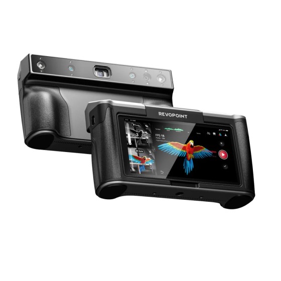
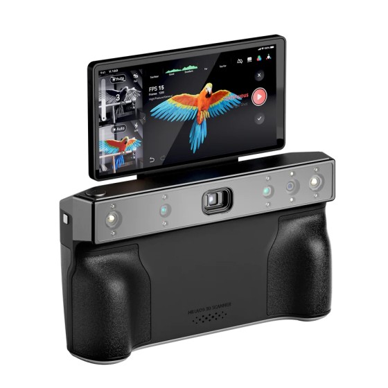
2. Integrated Design
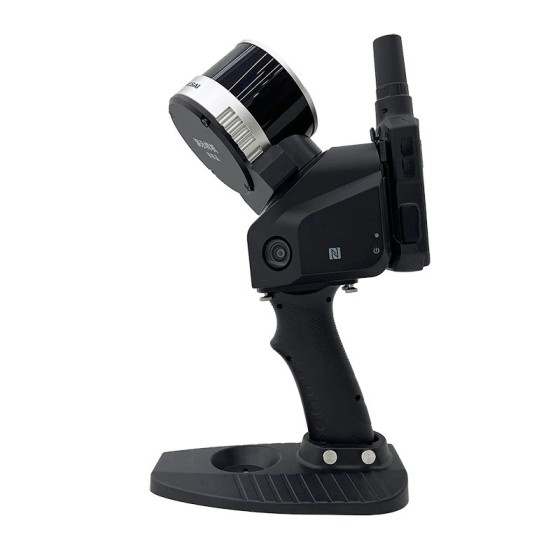
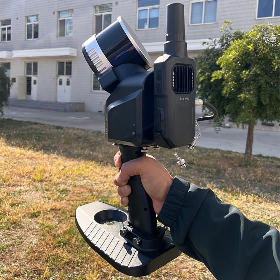
Lixel X1’s integrated design of LiDAR, visible-light camera, motion camera, high-precision inertial navigation technology, and high performance computing eliminates the tedious operation steps and makes your scan easier and simple. And the complex structure is of excellent heat-sinking capability.
3. Continuous Operation & Breakpoint Scanning
60 minutes of ultra-long continuous operation time and high capability in resuming the scanning from the break-point. No need for segmented scanning in large scenes and greatly improves the efficiency of measurement and data analysis.
4. Multi-platform Brackets
In addition to being portable, the Lixel X1 can be attached to a backpack, a vehicle and UAV. The flexibility makes the Lixel X1 a flexible mobile mapping solution in a variety of working locations.
Applications
- Topographic Mapping
- Agriculture & Forestry Survey
- Engineering Survey
- Volume Calculation
- Emergency Mapping
- Underground Space
Specifications:
- Operation Range: 0.05-120 m
- Laser: Class 1 / 905 nm
- Channels of Resolution: 16
- Accuracy: < 2cm
- FOV: 360° x 270°
- Points: 320,000
- Processing: Real-time processing
- Display: Live streaming point cloud
- Carrier: Handheld / Backpack / UAV
- Weight: <1,9 kg (with battery)
- Dimensions: 138 x 90 x 381 mm
- Camera: Wide field x 1, positioning x 3
- Operation Temperature: -20° C to 50°C
- Battery Life: 1.5h
- Single Scanning Time: 60 min
- Ingress Protection: IP54
- Storage Capacity: 1T SSD
- Point Cloud Format: .las, .laz
- Power Supply: V-mount 46,8 Wh, 14.4 V battery
- Power Consumption: <30w