lcp

Filter By

Brand

Brand

Price

Price

  • €0.00 - €24,800.00

Use

Use

Horizontal circle

Horizontal circle

Magnification

Magnification

Single Prism Range

Single Prism Range

Reflectorless Range

Reflectorless Range

Accuracy at 1 km double leveling

Accuracy at 1 km double leveling

Scope Magnification

Scope Magnification

Laser Beam

Laser Beam

Tilt Sensor

Tilt Sensor

Model

Model

Included Sensor

Included Sensor

Channels

Channels

UHF Radio modem

UHF Radio modem

Screen

Screen

Receiver for use with

Receiver for use with

Level Type

Level Type

Range

Range

Automatic Level Set

Automatic Level Set

Touchscreen

Touchscreen

IMU

IMU

Slope Setting

Slope Setting

Type

Type

Total Station Type

Total Station Type

Angle measurement accuracy

Angle measurement accuracy

Working Range with Receiver Ø

Working Range with Receiver Ø

Horizontal Levelling

Horizontal Levelling

Vertical Levelling

Vertical Levelling

GeoMax Zenith60 Pro GNSS... GeoMax Zenith60 Pro GNSS...
  • New
Quick View
WishList
Compare
Add To Cart

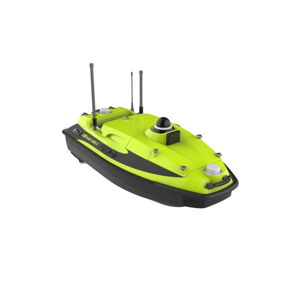
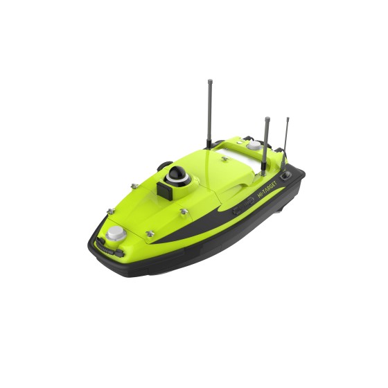
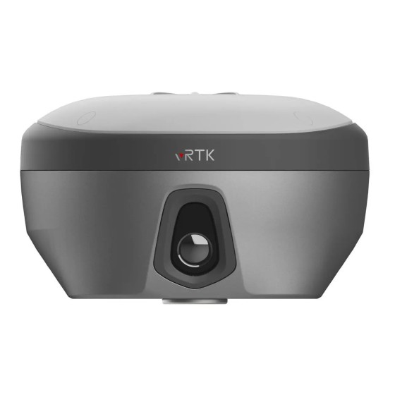
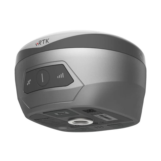
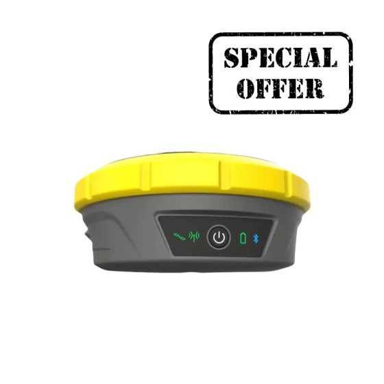
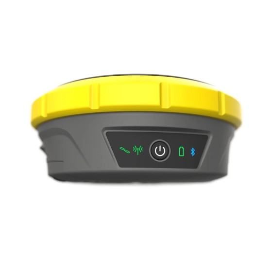
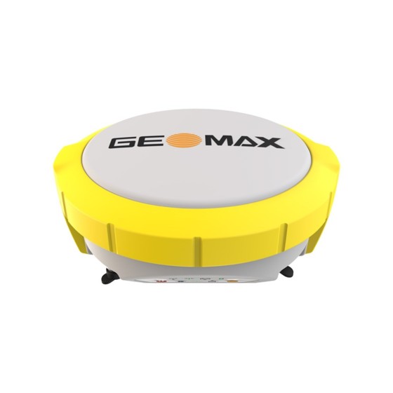
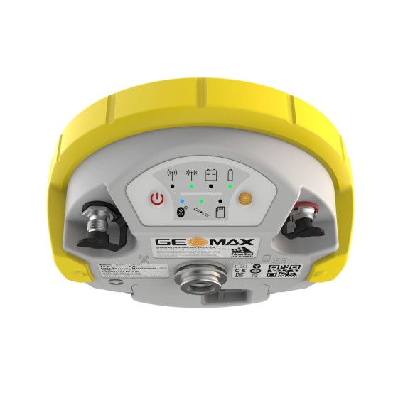
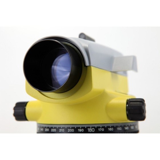
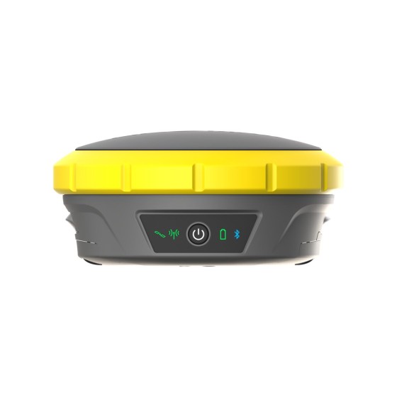
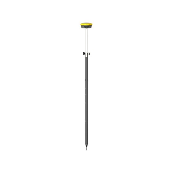
GeoMax Zenith60 Pro GNSS Smart Antenna

Redefining Accuracy and Reliability

The GeoMax Zenith60 Pro is the tool of choice for construction and surveying professionals who want their job done accurately and on time. It is a robust, durable and highly reliable GNSS smart antenna designed for high performance even in challenging conditions. Fully integrated with the GeoMax ecosystem – TPS and X-PAD Suite - it offers a comprehensive solution, resulting in unmatched precision and efficiency.

Hi-Target iBoat BS12 USV... Hi-Target iBoat BS12 USV...
Quick View
WishList
Compare
Add To Cart

Hi-Target iBoat BS12 USV Android-powered...

The iBoat BS12 emerges as the embodiment of sophistication and simplicity, expertly designed for effortless operation across a multitude of applications.

Engineered with the latest CFD technology and boasting a sleek carbon fiber and Kevlar hull, the iBoat BS12 is as tough as it is elegant. Its corrosion-resistant construction ensures durability in even the harshest conditions.

Matched with the newly developed boat control system and a robust 40km range battery, it achieves a remarkable top speed of 6 m/s, all while maintaining stability in tumultuous waters. For precise navigational accuracy, the integrated IMU offers sub-meter positioning capabilities.

Hi-Target vRTK GNSS RTK System Hi-Target vRTK GNSS RTK System
Quick View
WishList
Compare
Add To Cart

Hi-Target vRTK GNSS RTK System

Equipped with professional dual cameras, vRTK is Hi-Target’s first lightweight and innovative visual RTK receiver product, which not only enables non-contact image surveying, breaking through the objective constraints of previous work, but also improves the speed of stakeout with the function of Live View Stakeout. It greatly improves the work efficiency of engineering users.

GeoMax Zenith60 LTE Full... GeoMax Zenith60 LTE Full...
Quick View
WishList
Compare
Add To Cart

GeoMax Zenith60 LTE Full GNSS Receiver

Reliable and efficient, the GeoMax Zenith60 LTE Full GNSS Receiver is a powerful, calibration-free smart antenna which provides accurate, flexible, and fast work in the field. Incorporating state-of-the art technology, this newest addition to the Geomax GNSS system ensures an increase in productivity, and a smooth workflow to speed up your tasks.

Highlights:

  • Calibration-Free, Powerful Smart Antenna
  • 4G LTE Enabled for a Wider Reach
  • Accurate and Precise Data w/ Precise Point Positioning 
  • Electromagnetic Resistant
  • Extended battery life up to 12 hours
  • Reliable Tracking via 555 NovaTel channels
GeoMax Zenith16 Full GNSS... GeoMax Zenith16 Full GNSS...
Quick View
WishList
Compare
Add To Cart

GeoMax Zenith16 Full GNSS Receiver

Get higher success and productivity rates at an affordable price with the GeoMax Zenith16 Full GNSS Receiver. This receiver benefits from Hexagon’s cutting-edge technology and partnership with leading brands including NovAtel and SATEL, giving it superior positioning technology and easy configuration. 

Highlights:

  • 181 NovAtel Channels for reliable satellite tracking
  • Enhanced indoor operations with the optional SATEL UHF module
  • Quick and easy data transfer via Bluetooth and QR-iConnect functionality
  • IP68 dustproof and water-resistant rating
  • Long-lasting 9-hour battery life
GeoMax Zoom75 Robotic Total... GeoMax Zoom75 Robotic Total...
Quick View
WishList
Compare
Add To Cart

GeoMax Zoom75 Robotic Total Station

The GeoMax Zoom75 Series Robotic Total Station is packed with modern features to meet your surveying needs while remaining surprisingly affordable. This survey device is a smart choice for either construction professionals or surveying novices.

Highlights

  • Made for professionals and novices
  • Bluetooth equipped
  • Ease-of-use plus mobility
  • Data handling efficiency
  • accXess EDM technology
Angle measurement accuracy
1", 500m
1", 1000m
2", 500m
2", 1000m
3", 500m
3", 1000m
5", 1000m
5", 500m
GeoMax Zoom95 Robotic Total... GeoMax Zoom95 Robotic Total...
Quick View
WishList
Compare
Add To Cart

GeoMax Zoom95 Robotic Total Station

Guarantee the success of your surveying tasks with the GeoMax Zoom95 Series Robotic Total Station.  Equipped with many modern features such as the scout, track, and aim technology, or STREaAM360, this one-person total station substantially increases work accuracy and efficiency. The Zoom95 is also the logical step to fully digitizing your construction surveying needs.

Highlights

  • STReAM 360 technology
  • Data management on-site
  • Digitize the work area
  • Compatibility with 3rd party softwares
  • accXess EDM technology
Angle measurement accuracy
1", 500m
1", 1000m
2", 500m
2", 1000m
3", 500m
3", 1000m
5", 1000m
5", 500m
GeoMax Zoom50 Total Station GeoMax Zoom50 Total Station
Quick View
WishList
Compare
Add To Cart

GeoMax Zoom50 Total Station

The Geomax Zoom50 Series Reflectorless Total Station features high performance accXess EDM technology and a smart distance measurement engine that is tailored for outstanding range, speed, and precision. With a reflectorless range of up to 3,280 feet, the Zoom 50 has a typical measurement time of one second and is equipped with quadruple-axis compensation. This Geomax Total Station has an outstanding range of up to 11,483 feet using a single prism.

Highlights

  • Accuracy up to 5"
  • Reflectorless range up to 3,280 feet 
  • Internal memory up to 50,000 points 
  • Integrated Geomax Pro Onboard Field Software 
  • Built-in Bluetooth connectivity 
  • IP55 dustproof and low-pressure water jet resistant 
  • Battery Life up to 36 hours 
Angle measurement accuracy
1", 1000m
1", 500m
2", 500m
2", 1000m
5", 500m
5", 1000m
GeoMax Zoom40 Total Station GeoMax Zoom40 Total Station
Quick View
WishList
Compare
Add To Cart

GeoMax Zoom40 Total Station

The Geomax Zoom40 Series Reflectorless Total Station is an advanced innovative Surveying piece of equipment, utilizing neXus EDM technology, with a measuring range of up to 1,640 feet without requiring reflection of a prism. Using a single prism, the Zoom 40 has an extended range of up to 11,483 feet. This Total Station features quadruple-axis compensation for reliable angle measurements.

Highlights

  • Angular accuracy options: 2" or 5"
  • Single-prism range up to 11,482.94 feet 
  • Reflectorless range up to 1,640 feet 
  • Internal memory up to 2 GB 
  • Integrated GeoMax X-PAD, GeoMax FieldGenius, and Carlson SurvCE (sold separately) onboard software 
  • Built-in Bluetooth connectivity 
  • IP54 dustproof and water spray resistant 
  • Battery Life up to 36 hours 
Angle measurement accuracy
2"
5"
Hi-Target iRTK4 GNSS RTK... Hi-Target iRTK4 GNSS RTK...
  • Temporarily Out of Stock
Quick View
WishList
Compare
Add To Cart

Hi-Target iRTK4 GNSS RTK System

Hi-Target iRTK4 GNSS RTK is a full-featured, intelligent receiver system equipped with an integrated new-generation full-frequency antenna and advanced multi-channel engine, allowing users to attain accurate, reliable solutions. Users can also take advantage of calibration-free Tilt-Surveying without leveling the survey pole to collect point data in more places. In addition, the Smart Base function in iRTK4 automatically pairs the Rover with the Base by using Hi-Target global servers and ensuring communication by providing the best connection.

Hi-Target V200 GNSS RTK System Hi-Target V200 GNSS RTK System
Quick View
WishList
Compare
Add To Cart

Hi-Target V200 GNSS RTK System

Good things come in small packages

V200 GNSS RTK Receiver brings superior performance and high efficiency to support your fieldwork with reliable solutions. Its deployment of the advanced RTK engine and new-generation 9-axis IMU guarantees a 25% performance improvement even in the most demanding environments. Thus you can count on Hi-Target V200 for better productivity.

Navis-LiveData Advance... Navis-LiveData Advance...
Quick View
WishList
Compare
Add To Cart

Navis-LiveData Advance Access 1 year

-Navis-LiveData Advance Access 1 year-

Navis LiveData is cloud based web portal that allows viewing data form multiple Navis wireless wind sensors. It works by connecting Navis wireless wind sensors to Navis LiveData capable devices. Devices transmit data to Navis LiveData web interface. Data can be viewed globally on web browser using URL https://www.navis-livedata.com/.

GeoMax ZAL232 Automatic Level GeoMax ZAL232 Automatic Level
Quick View
WishList
Compare
Add To Cart

GeoMax ZAL232 Automatic Level

The Geomax ZAL232 Automatic Level is ideal for surveyors, construction professionals, builders and civil engineers for all daily levelling tasks and 360-degree horizontal angle measurements. This optical instrument features a rugged design, top-class optics, and an internal compensator to avoid readjustments, with 1/8 inch accuracy making it perfect for landscaping, fence building, layout and more.

Highlights

  • Circular level sensitivity: 8'/2mm
  • 3.28-foot minimum focusing distance
  • 360-degree horizontal circle
  • IP56 dust and water resistant
  • 5/8-11 tripod thread
  • 1-year warranty
Navis-LiveData Advance... Navis-LiveData Advance...
Quick View
WishList
Compare
Add To Cart

Navis-LiveData Advance Access 3 years

-Navis-LiveData Advance Access 3 years-

Navis LiveData is cloud based web portal that allows viewing data form multiple Navis wireless wind sensors. It works by connecting Navis wireless wind sensors to Navis LiveData capable devices. Devices transmit data to Navis LiveData web interface. Data can be viewed globally on web browser using URL https://www.navis-livedata.com/.

GeoMax MR240 Machine... GeoMax MR240 Machine...
  • On sale! -€186.00
  • -€186.00
Quick View
WishList
Compare
Add To Cart

GeoMax MR240 Machine Control Receiver

The Geomax MR240 Machine Control Receiver provides exact grade data for all visual machine control applications, with an extended range of up to 656 feet. It is perfect for use with backhoes, mini excavators, and other machines. With a 240-degree reception angle, this wireless receiver two detection accuracies - fine and coarse.

Highlights:

  • Extensive Range up to 656 feet 
  • 240° Reception Angle
  • Wireless laser receiver
  • Powerful earth magnets w/ attractive mounts 
  • LED indicators
  • Detection accuracies: Fine and Coarse 
  • Tough with IP67 rating water resistance
  • Battery life up to 130 hours 
GeoMax MD360 Remote Display GeoMax MD360 Remote Display
  • On sale! -€161.20
  • -€161.20
Quick View
WishList
Compare
Add To Cart

GeoMax MD360 Remote Display

The Geomax MD360 Remote Display provides an in-cab visualization that works with the MR360R machine control receiver. Featuring the latest radio frequency technology, this remote display offers wireless bi-directional communication which allows the user to change machine control receiver settings without leaving the cab. Also, it comes with nine display channels for a more reliable grading operation.

Highlights:

  • Works with MR360 machine control receiver
  • Wireless radio frequency link
  • Display channels: 9
  • Vertical indicator
  • Menu choices
  • Heavy-duty suction cup mount

Boxed:

Sticky Add To Cart

Font: